NOMAD
NOMAD (Network for Open Mobility Analysis and Data) is an infrastructure project designed to democratize access to large-scale GPS mobility data and standardize the analytical tools necessary for its use in human mobility science and epidemiology.
The project seeks to dismantle critical barriers that limit researchers’ and policymakers’ ability to effectively leverage human mobility data for research and policy design. By removing these obstacles, NOMAD also achieves an equity goal by enabling research by smaller and diverse institutions globally, and applications in historically data-poor regions.

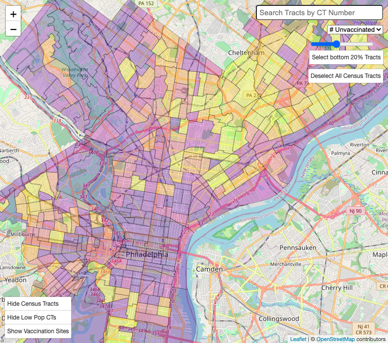
ABOVE: COVID-19 Places of Interest and Census Tracts
A sample from our in-progress COVID mapping dashboard. The map above visualizes Philadelphia’s COVID data and high-traffic destinations by Census Tract, providing an overview of how people move throughout the city.
See more about this project here.
PEOPLE
Duncan Watts
 —
—
Stevens University Professor & twenty-third Penn Integrates Knowledge Professor
Mark Whiting
 —
—
Research Scientist
Amir Ghasemian
 —
—
Affiliate Research Scientist
Jorge Barreras Cortes
 —
—
Ph.D. Researcher
Thomas Li
 —
—
Undergraduate Student Researcher
Andrés Mondragón
 —
—
Masters Student Researcher
FEATURED PUBLICATIONS
The exciting potential and daunting challenge of using GPS human-mobility data for epidemic modeling Journal Article
In: Natural Computational Science, vol. 4, pp. 398-411, 2024.
A citywide experiment testing the impact of geographically targeted, high-pay-off vaccine lotteries Journal Article
In: Nature Human Behavior, 2022, ISSN: 2397-3374.
Related
Overcoming the Challenges of GPS Mobility Data in Epidemic Modeling
Epidemic modeling is a framework for evaluating the location and timing of disease transmission events, and is a part of the larger field of human mobility science. The COVID-19 pandemic put existing epidemic models to the test, with many institutions and corporations employing models that utilized smartphone location data to measure human-to-human interactions and better understand potential transmissions and social distancing.
Researcher Spotlight: Jorge Barreras Cortes
Having just earned his Ph.D. in applied math in December, Jorge “Paco” Barreras Cortes kicks off 2023 as a fully fledged post-doctoral researcher at the CSSLab. He has driven the Lab’s work on epidemic modeling since 2020, grappling with the types of data, machine learning, and network science quandaries that underpin the toughest challenges in the field. Read on to learn more about his research journey in this month’s Researcher Spotlight.
What we learned from Philadelphia’s vaccine lottery
Whether developing a safe vaccine or figuring out how to encourage its adoption, the same scientific method — systematically experimenting to see what works and what doesn’t — is key.


